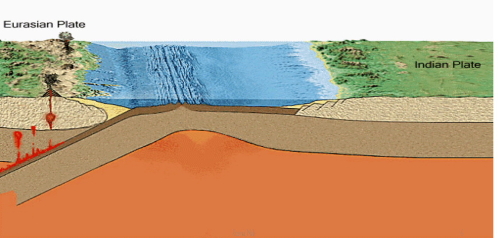
Formation of Himalaya

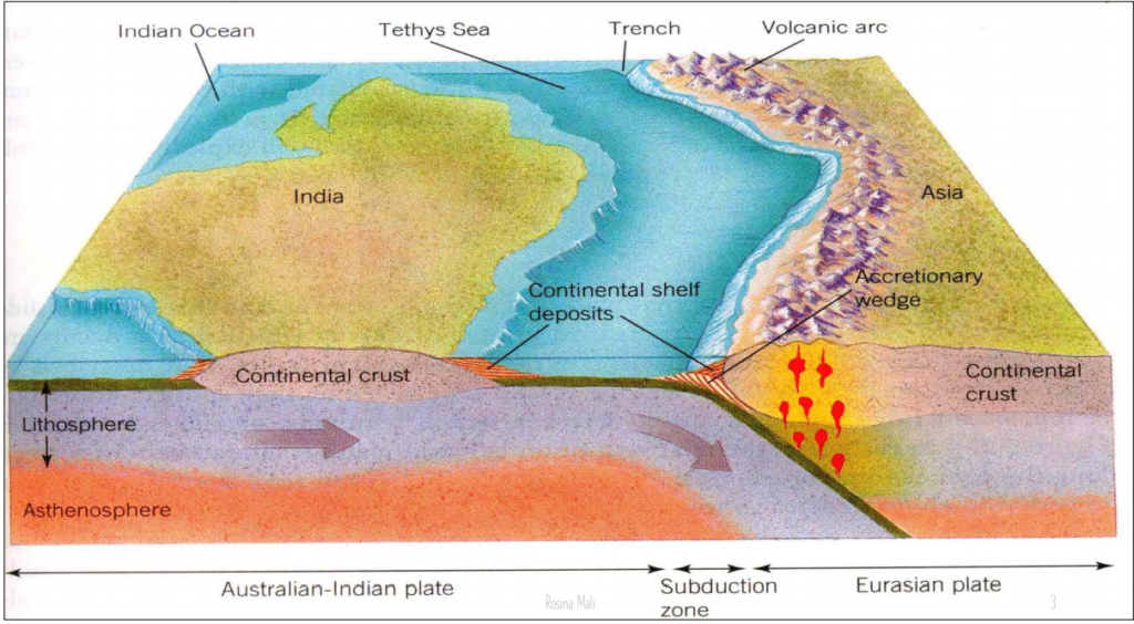
Shifting of Indian plate

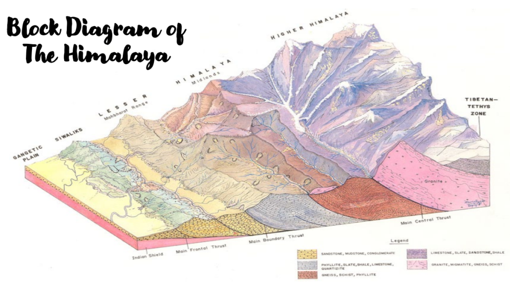
Block Diagram of The Himalaya
The Nepal Himalaya
• The longest division of the Himalaya
• Extended about 800 Km
• Starts from west at the Mahakali River
• Ends at the east by the Tista River
Longitudinal Division of Himalayan Range

Terai Zone (Gangetic Plain)
• Northern Terai
(Bhabhar Zone)
• Middle Terai
(Marshy) Zone
• Southern Terai Zone
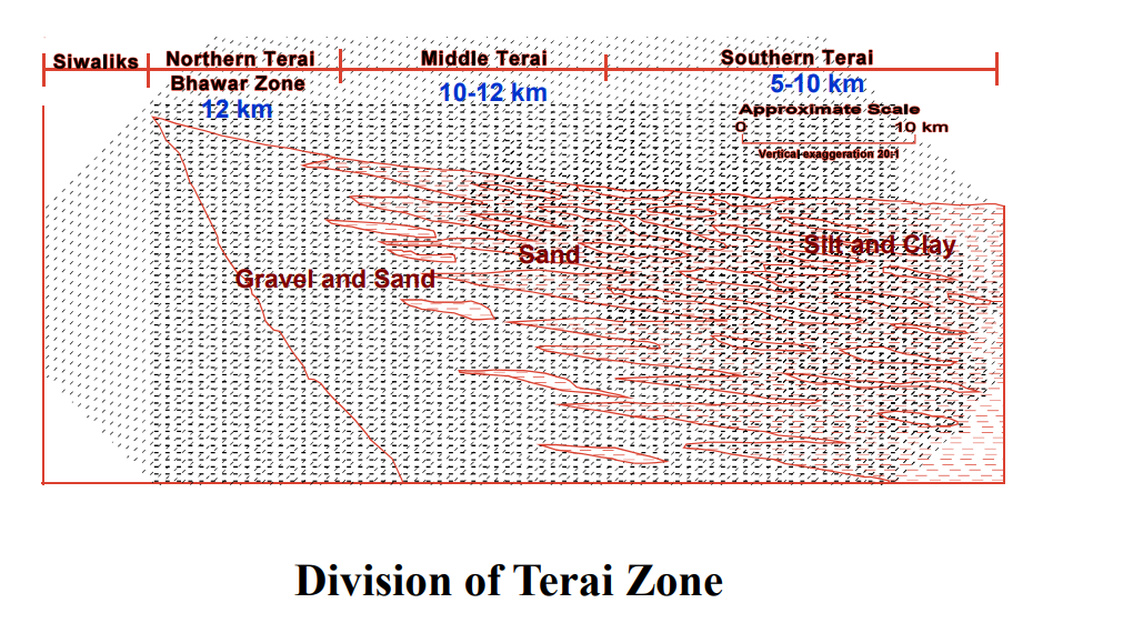
Major problems in terai zone
• Flood
• Liquifaction
• Bank cutting
• Subsidences
Himalayan Frontal Thrust (HFT) Separating Terai (S) from Siwaliks (N) at Butwal

The Sub-Himalayan Zone (Siwaliks)
• Delimited on the south by the Main Frontal Thrust (MFT) and on the
north by the Main Boundary Thrust (MBT)
• Fluvial deposits of 23 Ma to 1.6 Ma old
Siwaliks can be classified as
• Lower Siwaliks (Greenish grey fine-grained sandstone and siltstone
with mudstone)
• Middle Siwaliks (Medium to coarse-grained salt-and-pepper
sandstones with colorful mudstone)
• Upper Siwaliks (Conglomerate and boulder beds and
subordinately sand and silt beds)
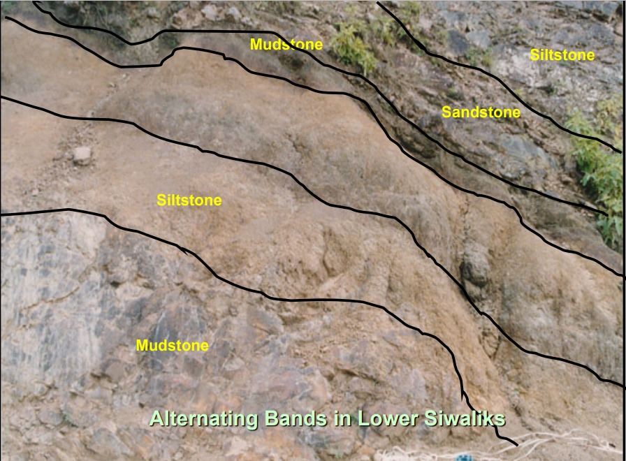
Main Boundary Thrust (MBT) in Dang

Major problems in Siwaliks
• Mass movement
• Erosion
• Weathering
Lesser Himalayan Zone
This zone Mainly contains
• Unfossiliferous, sedimentary, and metasedimentary rocks:
Such as slate, phyllite, schist, quartzite, limestone, dolomite, etc of very old
age (1600 Ma to 22 Ma)
• There are also some granitic intrusions in this zone
• In Eastern Nepal, high grade metamorphic rocks (gneiss and
schist)
• In Central Nepal, Medium to high grade metamorphic rocks
• In western Nepal around Gandaki and Bheri River, Low
grade of metamorphic rocks (quartzite, slate, and phyllite)
• In Far western Nepal, again high metamorphic rocks are
reappear.
Major problems in lesser Himalaya
• Mass movement:
• Rock slide,
• Rock fall
• Rock toppling
• Debris avalanche,
• Deep gully erosion,
• Wedge failure
• Flash flood
Main Central Thrust (MCT) at Myagdi

Higher Himalayan Zone
• Mainly consists of strongly metamorphosed rocks
• Separated with Tibetan-Tethys Zone by Normal
Faults
• Gneisses, schists, quartzites and marbles and
granites
Major problems of Higher Himalaya
• Mass movement
• GLOF
• Snow avalanches
Tibetan-Tethys Himalayan Zone
• It begins from the top of the Higher Himalayan
Zone and extends to the north in Tibet
• Well-developed in Mustang, Manang and Dolpa
area
• Composed of sedimentary rocks, such as shale,
limestone, and sandstone, ranging in age from 550
Millions age to 23 Millions age
Engineering Geological Problems in Himalayas
Terai Zone
Main rock type : Alluvium
Plane area has mainly problem of floods.
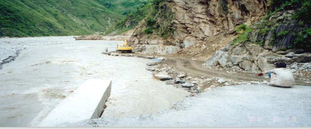
Siwaliks Zone
Main rock type: Shale, Conglomerate, Sandstone, Mudstone.
Composed of loose rock problem of relatively small and shallow slope failure.

Lesser Himalayan Zone
Main rock type: Slate, Phyllite, Schist, Genesis, Limestone, Dolomite, Quartzite.
Old hard rock, thick soil formation, thick colluvium deposits in lower part of mountain slope, problem of large slope failure.

Higher Himalayan Zone
Main rock type : Genesis, Schist, Quartzite.
Less soil formation, steep slopes, mainly rock slope failures.
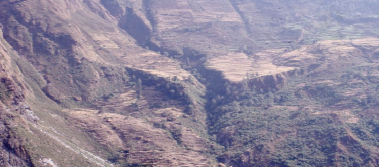
Tibetan Tethys Himalayan Zone
Main rock type: Limestone, Shale, Sandstone.
No soil formation, barren slope, rock slope failure, wind erosion, debris avalanche.

Why Himalayas are so vulnerable ????
• High relief (60-8848m): Slope failure,
• Active tectonics: Weak, unstable and permeable
thrust zone
• Seismically active
• Mass movement
• Concentrated Precipitation (93% in summer, 37%
in 24 hrs)
Hostile Natural Environment of Himalaya


