

Definition of surveying:
Surveying is the art of determining the relative positions of distinctive feature on the surface of the earth or beneath the surface of the earth, by means of measurements of distances, directions and elevations.
The branch of surveying which deals with the measurements of relative heights of different points on the surface of the earth, is known as levelling.
Primary Divisions of Surveying:
The surveying may primarily be divided into two divisions:
- Plane Surveying
- Geodetic Surveying
1. Plane Surveying:

The surveying in which earth surface is assumed as a plane and the curvature of the earth is ignored are known as Plane surveying.
As the plane survey extends only over small areas, the lines connecting any two points on the surface of the earth, are treated as straight lines and the angles between these lines are taken as plane angles.
Hence, in dealing with plane geometry and trigonometry is only required. Survey covering an area up to 260 sq.km may be treated as plane surveys because the difference in length between the arc and its subtended chord on the earth surface for a distance of 18.2 km, is only 0.1m.
Scope and use of plane surveying:
- It cover areas up to 260 sq.km and it is carried out for engineering projects on sufficiently large scale to determine relative positions of individual features of the earth surface.
- It is used for the lay-out of highways, railways, canals, fixing boundary pillars, construction of bridges, factories etc. The use and scope of plane survey is very wide.
2. Geodetic Surveying:
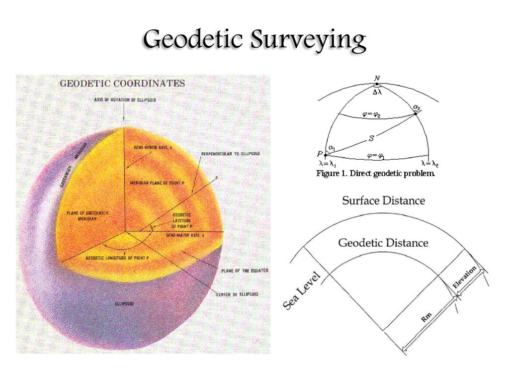
The surveys in which curvature of the earth is taken into account and higher degree of accuracy in linear as well as angular observations is achieved are known as Geodetic Surveying.
In geodetic surveying, curvature of earth’s surface is taken into account while making measurements on the earth’s surface. As the surveys extends over large areas, lines connecting any two points on the surface of the earth, are treated as arcs. For calculating their projected plan distances for the plotting on the maps, the curvature correction is applied to the measured distances. The angles between the curved lines are treated as spherical angles. A knowledge of spherical trigonometry is necessary of making measurements for the geodetic surveys.
Scope and use of Geodetic Surveying:
- It is conducted with highest degree of accuracy to provide widely spaced control points on the earth’s surface for subsequent plane surveys.
- It require the use of sophisticated instruments, accurate methods of observations and their computation with accurate adjustment.
Classification of Surveys:
A. Based on nature of field:
- Land Survey:
These include the following:
- Topographic surveys:
The surveys which are carried out to represent the topography of the mountainous terrain, rivers, water bodies, wooded areas and other cultural detail such as roads, railways, township etc. are called topographical surveys.
- Cadastral surveys:
The surveys which are generally plotted to a larger scale than topographical surveys and arc carried out for fixing the property lines, calculation of area of landed properties and preparation of revenue maps of state are called cadastral survey.
- City Surveys:
The surveys which are carried out for the construction of roads, parks, water supply system and other constructional work for any developing township are known as city surveys.
2. Hydrographic Surveys:
The surveys which deals with the mapping of large water bodies for the purpose of navigation, construction of harbor works and prediction of tides are called hydrographic surveys.
3. Astronomical Surveys:
The survey which are carried out for determining absolute locations i.e. latitudes of different places on the earth surfaces and the direction of any line on the surface of the earth by making observations to heavenly bodies i.e. stars and sun are called astronomical surveys.
B. Based on the objective of survey:
- Engineering Surveys:
The surveys which are carried out for designing engineering works, such as roads, reservoirs, water supply etc. are called engineering surveys.
- Military or Defense Surveys:
The surveys which are carried out for preparation of maps of the areas of Military importance are called military surveys.
- Mine Surveys:
The surveys which are carried out for exploration of mineral wealth beneath the surface of the ground i.e. coal, copper, gold etc. are called mine surveys.
- Geological Surveys:
The surveys which are carried out to ascertain the composition of the earth crust i.e. different strata’s of rocks of the earth crust are called geological surveys.
- Archaeological Surveys:
The surveys which are carried out to prepare maps of ancient culture i.e. antiquities are called archaeological surveys.
C. Based on the instrument used:
- Chain surveying
- Compass surveying
- Plane table surveying
- Theodolite surveying
- Tacheometric surveying
- Aerial surveying
- Photogrammetric surveying
- Triangulation surveying
Difference between Plane surveying and Geodetic surveying:
| Plane surveying | Geodetic surveying |
| 1. The earth surface is considered as plain surface. | 1. The earth surface is considered as curved surface. |
| 2. Surveying accuracy is low. | 2. Surveying accuracy is high. |
| 3. Uses normal instruments like chain, measuring tape, theodolite etc. | 3. Uses more precise instruments and modern technology like GPS. |
| 4. Carried out for a small area of Less than 260 sq.km. | 4. Carried out for area of more than 260 sq.km. |
| 5. The triangle formed by any three points is considered as plain. | 5. The triangle formed by any three points is considered as spherical. |
Principle of Surveying:
1. To work from whole to the part:
The main idea of working from whole to the part is to locate the errors to prevent there accumulation.
According to the principle the whole area is enclosed by main station (controlling station) and main survey line. The area is then divided into number of parts by forming triangles and squares. Advantage of this principle is errors can easily detected and eliminated.

2. To locate a point by taking at least two measurement from the fix reference points:
The relative position of the points to be surveyed should be located by measurement from at least two points of references, the position of which have already been fixed or known. Then the desired point can be plotted by making suitable measurements.

Scale, Maps and Plans:
A. Scales:
Scale is the fixed ratio that every distance on the plan bears with corresponding distance on the ground. Scale can be represented by the following methods:
- 1cm= 10m (1 cm in the plan represents whole number 10 on the ground).This is called as engineer’s scale.
Here,
1cm in plan represents 10m on the ground. It can be written as 1:1000. The term 1:1000 (R.F) is called representative fraction.
Choice of a scale of a map:
- Building= 1:1000 or less (1:250,1:500)
- Reservoir, town planning= 1:5000, 1:10,000
- Location survey= 1:5000, 1:20,000
- Small scale topographical map= 1:25,000
- Cadastral map= 1:5000, 1:2500
- Geographical map= 1:50,000, 1:1,00,000
Longitudinal section:
- Horizontal scale= 1:1000, 1:2000
- Vertical scale = 1:100, 1:200
Cross section:
1:100, 1:200
B. Plans and maps:
A plan is the graphical representation to some scale of the features or near or below the surface of earth as projected on the horizontal plane, which is represented by plane of the paper on which the plan is drawn. However, the surface of earth is curved and the paper of the plan or map is plane. No part of the surface can be represented on such map without distortion. In plane surveying, the area involved are small and the earth surface is taken as plane and the plan is prepared using orthographic projection on a large scale.
The representation of orthographic projection on a large scale is called map. On the map, the vertical distance are also represented by contour line and other system.
Units of Measurements:
In metric system:
- Basic units of length in metric system.
10 millimeters (mm) = 1 centimeter (cm)
10 centimeter (cm) = 1 decimeter (dm)
10 decimeter (dm) = 1 meter (m)
10 meter (m) = 1 dekameter (da)
10 dekameter (da) = 1 hectameter (hm)
10 hectameter (hm) = 1 kilometer (km)
1.852 kilometer (km) = 1 nautical mile (nmi)
- Basic units of area in metric system:
100 sq. meter = 1 are
10 are = 1 deka-are
10 deka-are = 1 hecta-are
- Basic units of volume in metric system:
1000 cubic millimeter = 1 cubic centimeter
1000 cubic centimeter = 1 cubic decimeter
1000 cubic decimeter = 1 cubic meter
In F.P.S system:
- Basic units of length in F.P.S system:
12 inches = 1 foot
3 feet = 1 yard
5.5= 1 rod, pole or 1 sq. perch
4 poles = 1 chain (66 feet)
10 chains = 1 furlong
8 furlong = 1 mile
6 feet = 1 fathom
120 fathoms = 1 cable length
6080 feet = 1 nautical mile
- Basic units of area in F.P.S system:
144 sq. inch = 1 sq. foot
9 sq. feet = 1 sq. yard
30.25 sq. yard = 1 sq. rod or pole
40 sq. rods = 1 rood
4 roods = 4 acres
640 acres = 1 sq. mile
484 sq. yards = 1 sq. mile
484 sq. yards = 1 sq. chain
10 sq. chains = 1 acre
- Basic units of volume in F.P.S system:
1728 cu. Inches = 1 cu. Foot
27 cu. Feet = 1 cu. Yard
Conversion:
Conversion factor for length:
(meters, yards, feet and inches)
| Meters | Yards | Feet | Inches |
| 1 | 1.0936 | 3.2808 | 39.37 |
| 0.9144 | 1 | 3 | 36 |
| 0.3048 | 0.3333 | 1 | 12 |
| 0.0254 | 0.0278 | 0.0833 | 1 |
Conversion factor for areas:
(Sq. meters, Sq. yards, Sq. feet and Sq. inches)
| Sq. meters | Sq. yards | Sq. feet | Sq. inches |
| 1 | 1.196 | 10.7639 | 1550 |
| 0.8361 | 1 | 9 | 1296 |
| 0.0929 | 0.1111 | 1 | 144 |
| 0.00065 | 0.00077 | 0.0069 | 1 |
Conversion factor for areas:
(Ares, acres, Sq. meters and Sq. yards)
| Ares | Acres | Sq. meters | Sq. yards |
| 1 | 0.0247 | 100 | 119.6 |
| 40.469 | 1 | 4046.9 | 4840 |
| 0.01 | 0.000247 | 1 | 1.196 |
| 0.0084 | 0.00021 | 0.8361 | 1 |
Conversion factor for volumes:
(Cub. meters, Cub. yards, Gallons)
| Cub. meters | Cub. yards | Gallons |
| 1 | 1.308 | 219.969 |
| 0.7645 | 1 | 168.178 |
| 0.00455 | 0.00595 | 1 |
Nepalese customary units of measurement:
Length:
1 angul = approx. 0.75 inch
4 angul = 1 dharnugrah = 3 inch
8 angul = 1 dhanurmushti = 6 inch
12 angul = 1 vitastaa = 9 inch
2 vitta = 18 inch
1 haath = 1.5 feet
1 dand or dhanush = 4 haath = 6 feet
2000 dand = 1 kosh or Gorut = 4000 yards or 2.25 miles
4 kosh = 1 yojan = 9 miles = 14.48 km
Area:
1 khetmuri = 25 ropani
1 bigha = 20 katha = 6772.63 m2 = 72900 sq. ft = 13.31 ropani
1 katha = 20 dhur = 339.63 m2 = 364 sq. ft
1 dhur = 16.93 m2 = 182.25 sq. ft
1 ropani = 16 aana = 64 paisa = 508.72 m2 = 5476 sq. ft = 256 daam = 4llka
1 aana = 4 paisa = 31.80 m2 = 342.25 sq. ft = 16 daam
1 paisa = 4 daam = 7.95 m2 = 85.56 sq. ft
1 daam = 1.99 m2 = 21.39 sq. ft
Terai region:
1 katha = 20 dhur
1 bigha = 20 katha
Conversions for Terai customary units:
| Unit | Divisions | In sq. meter | In sq. feet |
| Dhur | – | 16.93 sq. meter | 182.25 sq. feet |
| Katha | 20 Dhur | 338. 62 sq. meter | 3645 sq. feet |
| Bigha | 20 Katha | 6772.41 sq. meter | 72900 sq. feet |
Hilly and mountainous region:
1 paisa = 4 daam
1 aana = 4 paisa
1 ropani = 16 aana
Conversions for Hilly and mountainous customary units:
| Unit | Divisions | In sq. meter | In sq. feet |
| Daam | – | 1.99 sq. meter | 21.39 sq. feet |
| Paisa | 4 Daam | 7.95sq. meter | 85.56sq. feet |
| Aana | 4 Paisa | 31.80 sq. meter | 342.25 sq. feet |
| Ropani | 16 Aana | 508.71 sq. meter | 5476 sq. feet |
Volume:
10 mutthi = 1 mana
8 mana = 1 pathi
20 pathi = 1 muri
Accuracy and Error:
1. Accuracy :
The degree of perfection obtained is known as accuracy.
Accuracy depends on:
- Preciseness of instrument
- Preciseness of surveying methods
- Planning
2. Error:
A discrepancy is defined as the difference between two measured value of same quantity. However, measurements are never exact and there will always be a degree of difference regardless of the survey instrument or method used. These difference are known as error.
Also, true error is defined as the difference between a measurement and the true value of quantity measured. Permissible error is defined as the allowable limit that a measurement may vary from true value.
Source of error:
- Instrumental errors: Due to imperfection of instrument.
- Personal errors: Error on observed value, error in reading, writing.
- Natural errors: Due to temperature, wind, humidity, local attraction ( magnetic declination)
Kinds of errors:
- Mistake
- Systematic error
- Accidental error
- Mistake:
Mistake are the error which arise from inattention, inexperience, carelessness and poor judgment or confusion in the mind of observer. If a mistake is undetected, it produces a serious effect on the final result. Hence, the every value to be recorded in the field must be checked by same independent field observation.
2. Systematic error ( Cumulative error)
A systematic error or cumulative error is an error under the same conditions will always be of the same size and same sign. A systematic error always follows some definite mathematical or physical law. Correction can be determined and applied. Such errors are of constant characters and regarded as positive or negative.
To prevent systematic error:
- All the surveying instruments must be designed and used so that whenever possible systematic error will be automatically eliminated.
- The nature of error and their relationship should be identified for eliminating.
3. Accidental error ( Compensating error)
Accidental errors is that error which remains after mistake and systematic error have been eliminated and are caused by a combination of reason beyond the ability of observer to control. They sometimes tends in one direction and sometimes in another direction. Accidental error represents the limits of precision in the determination of a value. They obey the law of chance and therefore must be handled according to the mathematical law of probability.
Stages of Survey Operations:
The entire work of a survey operations may be divided into three distinct stages:
- Field work
- Office work
- Care and adjustment of the instruments
1. Field work:
The field work consists of the measurement of distances and angles required for plotting to scale and also keeping a systematic record of what has been done in the form of a field book or measurement book.
Field work is divided into three stages:
a. Reconnaissance
b. Observations
c. Field Record
a. Reconnaissance:
During reconnaissance the surveyor goes over the area to fix a number of stations, ensuring necessary indivisibility, to establish a system of horizontal control.
b. Observations:
The surveyor makes necessary observations with survey instruments for linear and angular measurements. The observations also include determination of difference in elevations between the stations, establishment of points at given elevation areas and bathymetric contours of water bodies.
c. Field records:
All the measurements are recorded in a field book. Every care is made to ensure correct entries of all the observations otherwise the survey may be useless.
The operations which a field surveyor is required to do in the field are as follows:
- Selection of the sites and establishment of stations and bench marks in the area.
- Measuring the horizontal distances between stations either by chaining on the surface of the earth or by trigonometrically computation.
- Locating the detail points with respect to survey lines such as in chain surveying or by methods of plane tabling.
- Determination of elevations of stations and bench marks either by spirit levelling or by trigonometrical levelling.
- Surveying contours of land areas and bathymetric contours for water bodies.
- Determination of latitude, longitude or local time by making astronomical observations to either the sun or stars.
Important rules for note keeping:
- As soon as observations are made, readings should be recorded in the field book. Nothing should be kept in mind for recording later.
- Only one field book should be maintained.
- Entries should be made by a sharp 2H or 3H pencil and not by a soft pencil. This keeps the field book neat and clean.
- Style of writing should be consistent and numerical should be bold and legibly written.
- Neat sketches should invariably be drawn to explain relative positions and directions.
2. Office work :
The field notes are brought to the office and necessary drafting, computing and designing work are done by draftsmen and computers.
- Drafting:
This process consists of preparation of plans and sections by plotting the field measurements to the desired scale.
- Computing:
This process consist of calculating data necessary for plotting and also includes determining the areas and volume for the earth work.
- Designing:
This process consists of selection of best alignment of roads, railways, canals etc. on the plotting plans.
3. Care and adjustment of instruments:
A great care is required to handle survey instruments. A beginner should always be made familiar with care and adjustment of the instruments and its limitation.
Following precautions must be taken:
- While removing a theodolite or a level from its box, do not lift it by its telescope. It should be lifted by its standards by placing hands under the levelling head or the foot plate.
- While carrying an instruments from one place to the other, it should be carried on the shoulder if the distance is short, otherwise it should be carried in its box.
- The instruments must be kept clean and frequently dusted with a small brush. Lenses should be inserted in the joints or cracks.
- Do not leave the instrument on the roads, foot paths or in unguarded postures.
- Do not force the foot- screws and tangent screws too hard.
References: 1. A text book of surveying and levelling, R. Agor , Khanna publication